We’ve created a series of routes that we’ve called belts—because they aren’t quite circles but they’re a kind of wiggly loop that will help you traverse from point a. to b.
Each belt intersects with other belts allowing you to explore other parts of town without ever getting lost. Each belt has a downloadable GPX file that you can upload to your favorite GPS map system. We highly recommend Komoot(its FREE! and has fantastic features) as it allows for areas that aren’t always recognized as a road(most main roads in Toledo are not recommended for cycling unless you see a bike lane or a large shoulder
—so in some instances you may connect by sidewalk or off-road segment for a short distance). Our routes are almost always through neighborhoods but in some instances connectors only make sense by sidewalk or a small off-road section to place a cyclist in the next safe section of a route. With that said, sidewalks should be used with caution—please walk your bike.
We highly recommend studying each route thoroughly before riding so there are not any surprises.
Routes may have a very short off-road or short segment of sidewalk. Most recently added routes have sections of road that do not include a bike lane — understand what you are comfortable navigating.
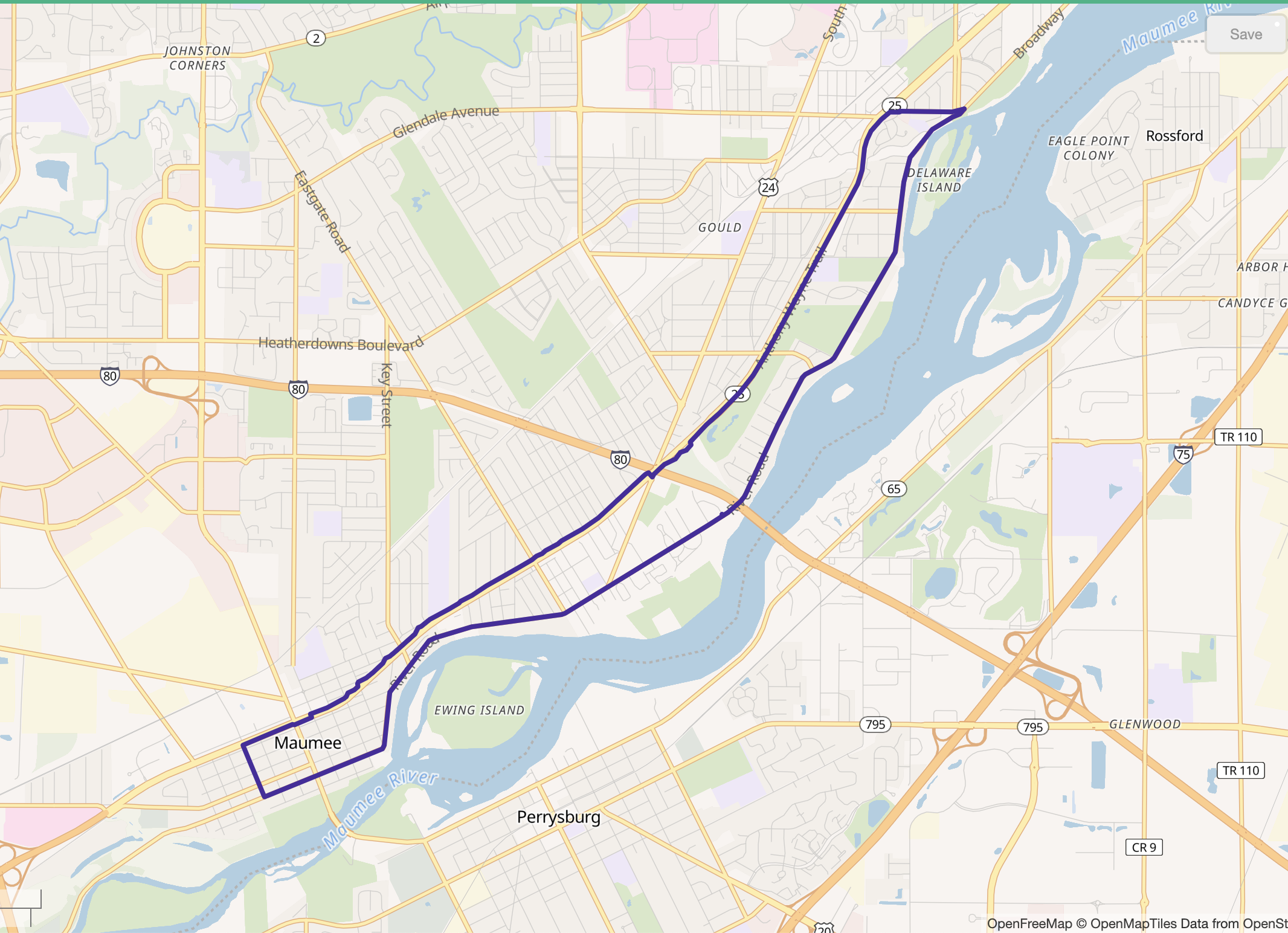
NEW! MAUMEE OH RIVER BELT
NEW! Anthony Wayne Sidepath/Downtown Maumee/Chessie Circle Trail South/River Road — 11.4 Miles
Connects or overlaps with Maumee OH North Belt
Includes a 6 mile section of low traffic road—no bike lane

NEW! MAUMEE OH NORTH BELT
Swan Creek Metropark/UTMC/Chessie Circle Trail South — 11.4 Miles
Connects or overlaps with Maumee OH River Belt
Includes an intermediate paved section with no bike lane from Rolf Park to the Anthony Wayne Side Path
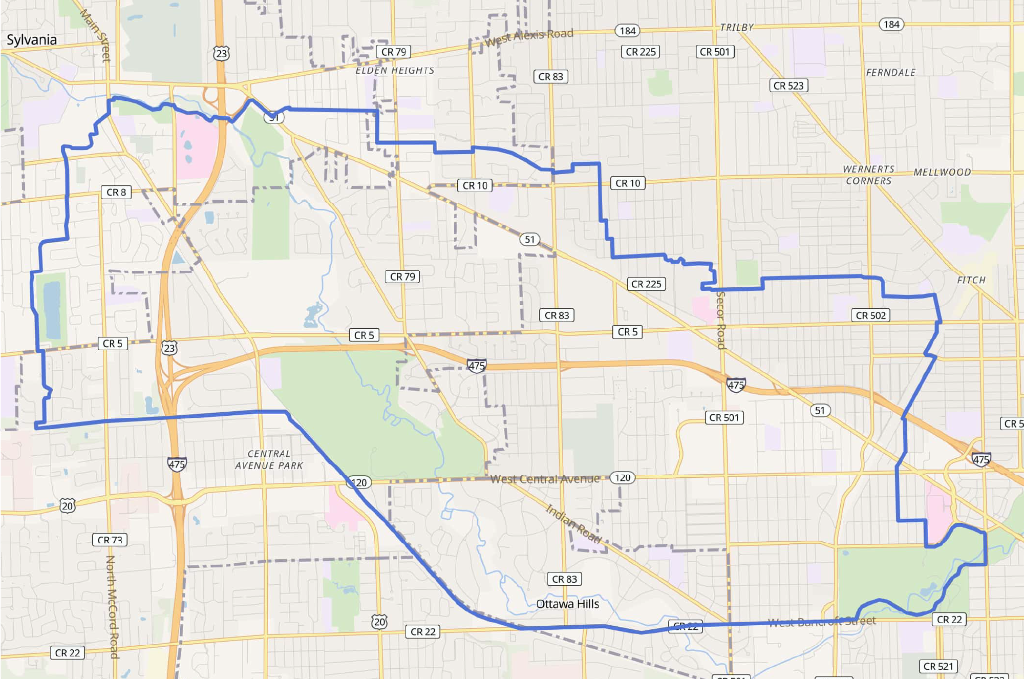
BLUE BELT
Downtown Sylvania/University Park Trail/Franklin Park — 20.5 Miles
Connects or overlaps with Purple Belt, Orange Belt, Green Belt, Yellow Belt, Red Belt
Includes 2 short segments of sidewalk and one short off-road segment


PURPLE BELT
Sylvania/Toledo/Franklin Park/Trilby/Downtown Toledo — 25 Miles
Connects or overlaps with Blue Belt, Red Belt, Orange Belt
Includes 1 short segment of sidewalk and one short off-road segment

RED BELT
East Sylvania/Franklin Park/Ottawa Hills/Old Orchard/Cricket West/WestGate — 9.2 Miles
Connects or overlaps with Purple Belt, Blue Belt
Includes 2 short segments of sidewalk and one short off-road segment


ORANGE BELT
U.T./Old Orchard/DeVeaux/Library Village/West Toledo — 11.4 miles
Connects or overlaps with Blue Belt, Purple Belt
Includes 1 short segments of sidewalk and one short off-road segment


YELLOW BELT
Sylvania/Secor Metropark/Irwin Prarie/Centennial Terrace & Quarry/Highland Meadows Golf Course — 22.8 miles
Connects or overlaps with Blue Belt, Green Belt
Includes 1 short segment of sidewalk and one gravel segment


GREEN BELT
Sylvania/Toledo/Botanical Gardens/Wildwood — 15.7
Connects or overlaps with Blue Belt, Yellow Belt
Includes 1 short segment of sidewalk
